Cornwall, England
A View to Roche Rock
A prehistoric archaeological investigation
Cornwall, England
A prehistoric archaeological investigation
The Story
Throughout human history, people have formed and preserved sacred bonds with the natural environment, from painting on cave walls to building shrines atop mountains.
This is no different in Cornwall, southwest England, where ancient peoples constructed massive stone monuments across a region famous for its rugged, undulating terrain. Today, we can see the remnants of what they built through the hundreds of megaliths still standing and the archaeological evidence that lies beneath the surface.
All this evidence of past human activity forms what we call the prehistoric landscape, a fundamental concept in landscape archaeology. But what is left today is just a fragment of a once rich cultural tapestry. Once we understand context, certain patterns start to appear.
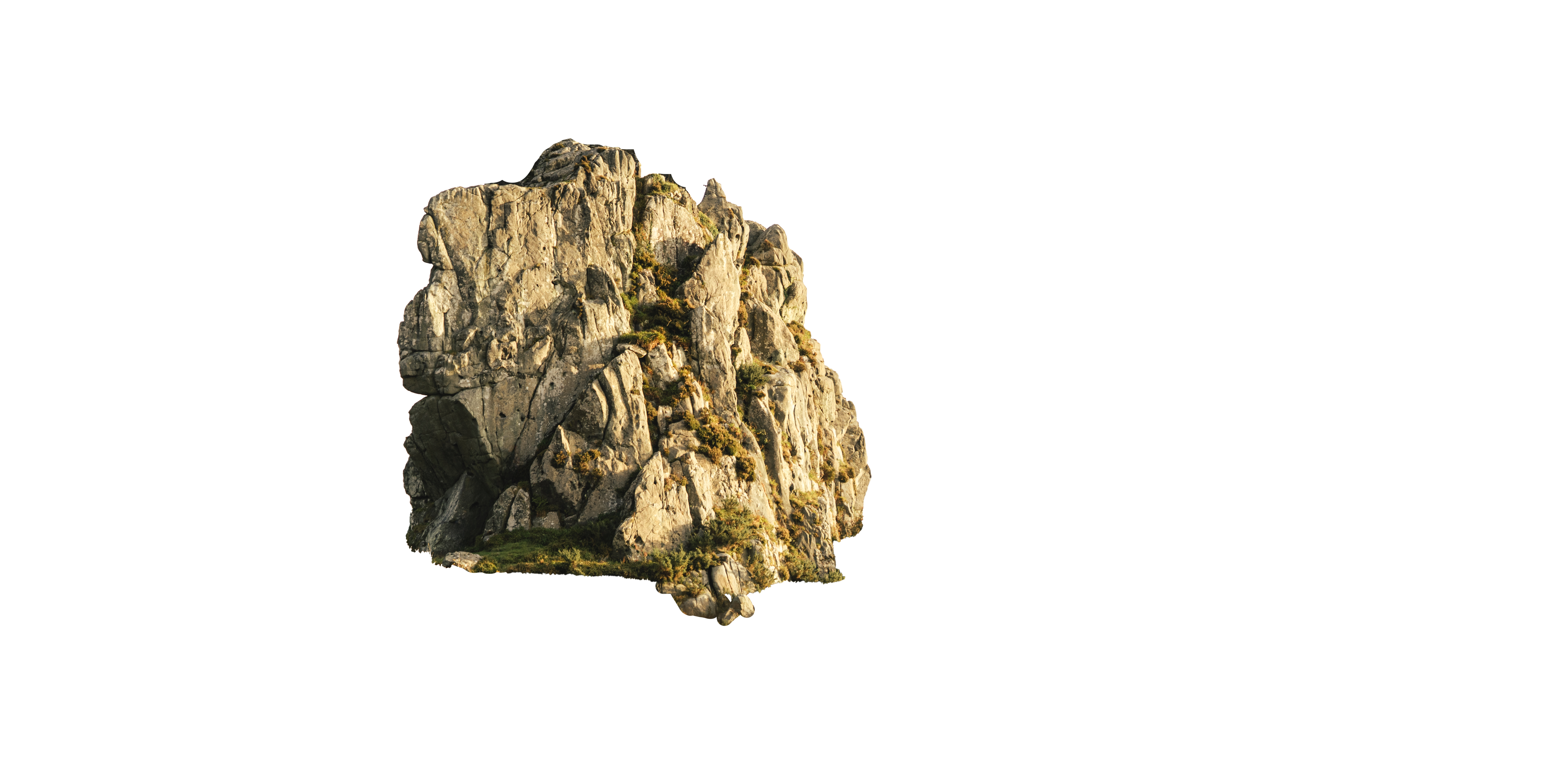
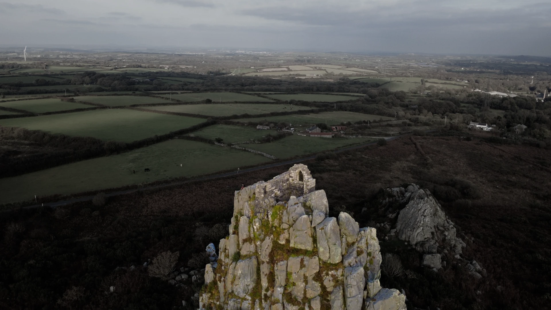
Roche Rock, rising high in the mid-Cornwall moorlands, has held meaning for generations of humans. Today, the site is protected and revered among locals. Could this have been true for the people who lived here thousands of years ago?
This project explores this question by combining geospatial analysis and archaeology with 3D models, 360°; imagery, and drone capture, all woven into an interactive map of the prehistoric landscape around Roche Rock.
Keep scrolling to discover the fascinating story of prehistoric Cornwall.
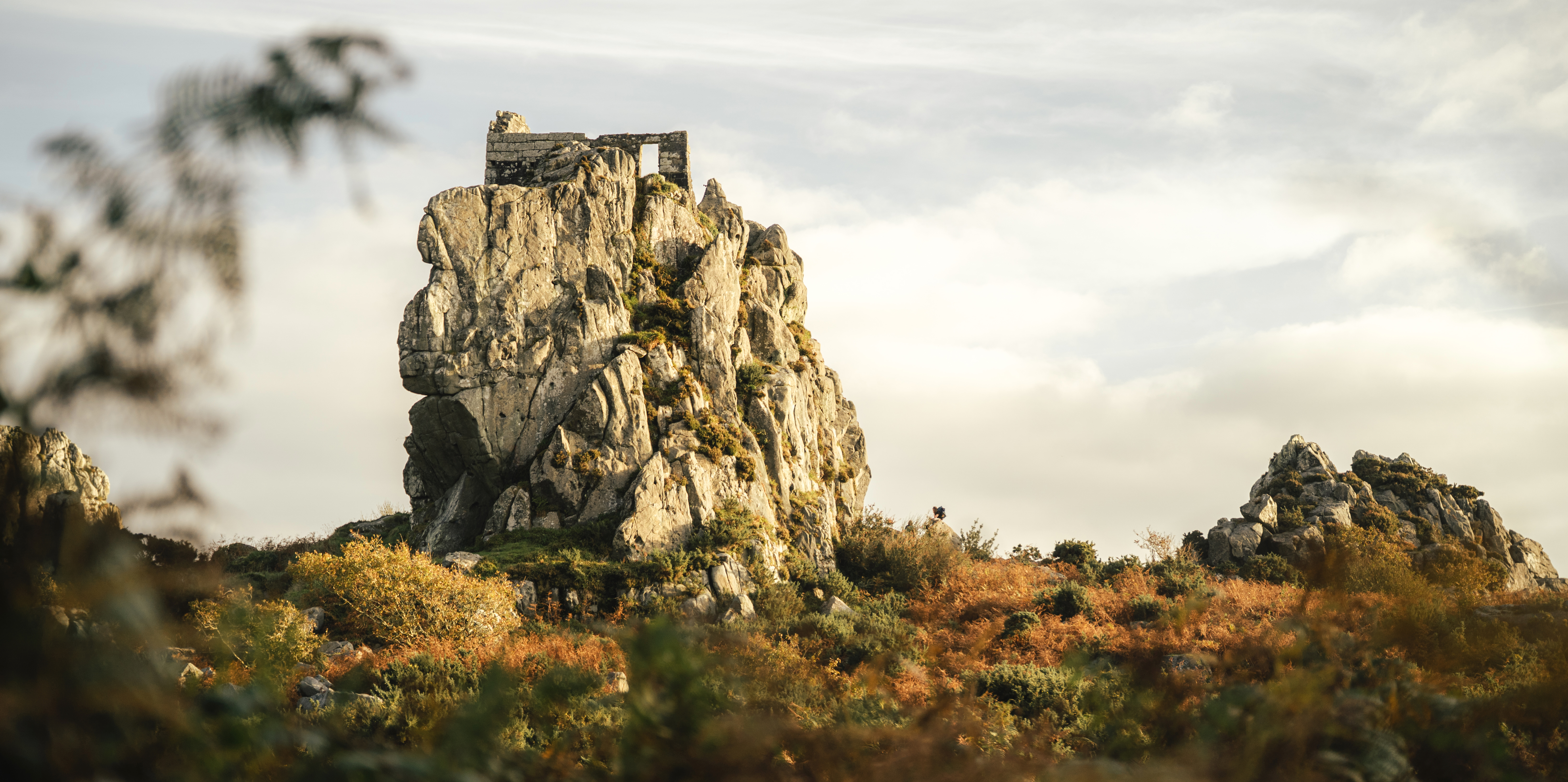
Roche Rock is 22 metres high and composed of quartz and a mineral called black tourmaline, known as schorl.
The medieval chapel on top of the rock was dedicated to St. Michael, a popular saint in Cornwall.
Surrounded by flat terrain, Roche Rock would have been visible for miles, and for thousands of years.
Interactive 3D Model
An interactive 3D Gaussian Splat reconstruction of Roche Rock, captured in 2025. Explore the rock face, chapel ruins, and surrounding landscape from every angle.
Note: This viewer may be demanding on older or mobile devices.
This is Roche Rock.
On a clear day, Roche Rock is easily visible from miles away.
However, this doesn't account for the Earth's terrain, which can alter visibility.
To factor in terrain, a viewshed analysis can be conducted.
This is a viewshed.
It incorporates available topographic data to help determine visibility.
If you were standing on Roche Rock, this is where you'd be able to see on a clear day.
There's an intriguing pattern that emerges once you factor in something else.
Keep investigating to find out...
Cornwall has been inhabited for thousands of years, with evidence of human activity dotted all around the region.
These are all the documented Neolithic and Bronze Age sites found in Cornwall.
If you intersect this data with the viewshed, you start to see that Roche Rock was viewable from many of these prehistoric sites.
Unique geological formations — such as Roche Rock — have widely been theorised to have held spiritual meaning for many ancient cultures.
Could Roche Rock have been sacred for the ancient inhabitants of Cornwall?
Find the answers ↓Click any marker to discover the site's story, media, and archaeology.